+7 (812) 328 9282 - Office, +7 (812) 328 9248 - Museum info@karpinskyinstitute.ru
Russian Geological Research Institute (VSEGEI)
From June 25 to October 1, 2020, the Balygychan Party of the Department of Methods of the State Geological Mapping and Geological Surveying was engaged in field work as part of the second stage of the Additional Site Exploration-200 with preparation for the publication of sheets P-56-V, VI (Balygychan Area), as well as field trials for assessing prospects for gold-silver mineralization in the northern part of the Balygychan-Sugoi Trough. The study area is located on the border of the Srednekansky and Omsukchansky districts of the Magadan Region. Economically, the territory is poorly developed; there is no permanent population there, human economic activity is reduced to seasonal crafts (hunting and fishing), geological exploration, and tourism. There are destroyed uninhabited Balygychan and Solnechny settlements in the area. There are no permanent roads and infrastructure; transfer between encampments is only possible by tracked vehicles or boats along the Balygychan and Sugoi rivers. With the exception of these rivers, all watercourses are fordable.
In the central part of the Balygychan Area, in the interfluve of the large right tributaries of the Kolyma River, the Balygychan and Sugoi rivers, there is a large regional structure, the Balygychan-Sugoi Trough. This structure is associated with numerous deposits and ore occurrences of various types, including noble metals: Arylakh, Lunnoe, Zeleny, Askold, Mechta, Tidid, Krasin and others. The most famous and largest of them is the Dukat deposit.
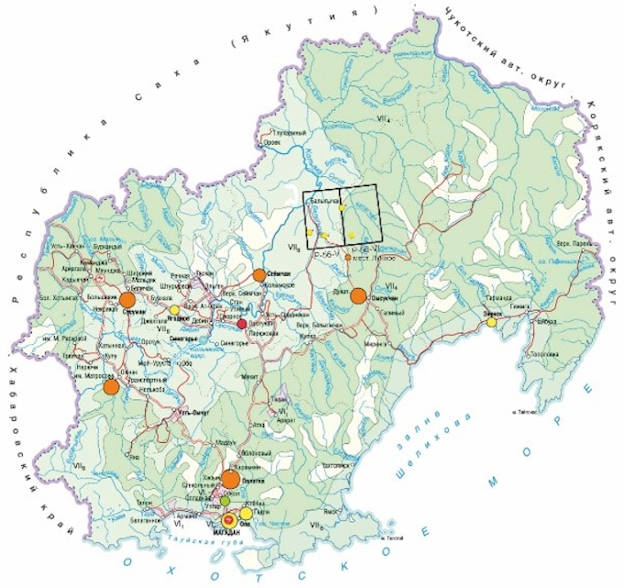
Layout of sheets P-56-V, VI in the Magadan Region
The Balygychan Party consisted of thirty six people: eight employees of FGBU VSEGEI, eight employees of the Norilsk Branch of FGBU VSEGEI, who performed ground geophysical work, and twenty seasonal workers.
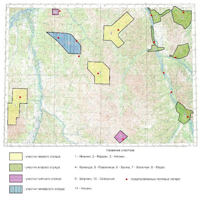
The Balygychan Field Party headed by S.Yu. Petrov consisted of four field crews that worked in eight prospects; the layout of their location is given below (Head of the first crew was D.K. Perlov, second, G.V. Saveliev, third, R.V. Chervyakov, forth, D.Yu. Tseplyaev).
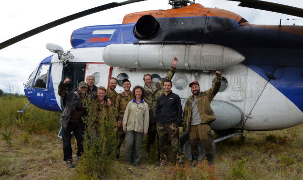
Delivery of personnel and equipment of the party to the work area was performed by air and motor transport along the route St. Petersburg - Magadan - Omsukchan Settlement respectively. The transfer to the work area and then across the area was performed by three types of transport: cross-country vehicle, boat and helicopter. The latter prevailed, since the territory is hard to reach.
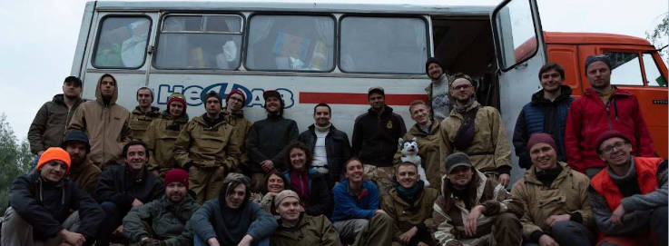
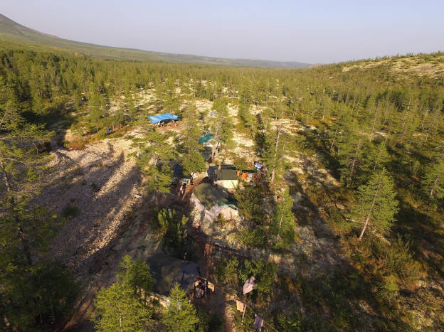
Balygychan party of FGBU VSEGEI without the Norilsk Branch
Field studies included ground-based editorial-correlating, geological surveying and prospecting routes to study pre-Quaternary and Quaternary formations, routes for compiling reference stratigraphic (lithological) sections, as well as an accompanying two-dimensional lithochemical survey along secondary dispersion halos.
In the course of work, samples were taken to determine the chemical composition of rocks, to make thin sections and polished sections, to perform isotope-geochronological studies. Sampling was carried out mainly from eluvial and slope formations, as bedrock outcrops are rare in this area. Heavy mineral concentrate sampling of loose sediments, uncovered in natural outcrops, in strippings and sampling pits, was also carried out.
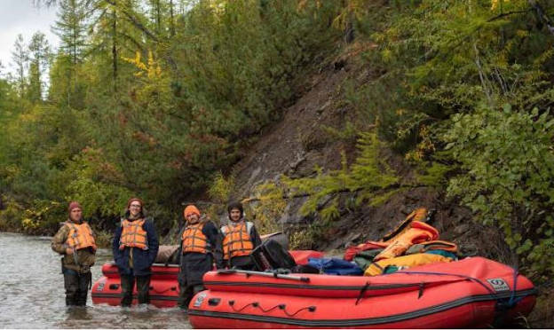
Rafting crew headed by G.V. Saveliev
To solve prospecting, assessing and mapping tasks, in addition to geological routes, prospecting routes at a scale of 1:50,000 and lithochemical surveys at a scale of 1:25,000 and 1:50,000 were also performed. The works were carried out in the Nizhnyaya, Shermen, Nyagain and Severny prospects. Based on the results of the work, it is possible to distinguish two areas with confident potential.
The Norilsk Branch of FGBU VSEGEI made ground geophysical surveys in the Shermen Prospect, which, according to the results of work on the assessment of exploration and Additional Site Exploration-200, was assessed as the most promising for gold-silver mineralization. In the prospect, a survey on secondary dispersion halos at a scale of 1:25,000 along a network of 50x250 m was also carried out. Zones with sulfide mineralization in quartz light-mica metasomatite confined to the contact of felsic intrusions with host terrigenous rocks were identified.
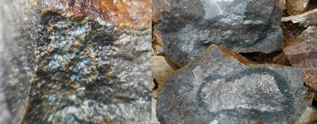
Sulfide mineralization from the Shermen Propsect
Based on geophysical criteria and direct indicators of ore mineralization, two promising areas have been identified for complex (Ag, W, Pb, Sn) gold mineralization. The results obtained make it possible to predict an ore target of hydrothermal-metasomatic genesis with gold-silver and gold-rare metal formations in the Shermen Prospect.
The base of the crew headed by R.V. Chervyakov in the Shermen Prospect
In the course of exploration of the Nizhnyaya Prospect, located on the left bank of the Balygychan River, the crew identified a zone of metasomatite of the quartz-light-mica group genetically related to the buried Nizhnensky granodiorite massif of the Bystrinsky Complex and cutting faults of sublatitudinal and northeastern strike. Metasomatic formations are accompanied by sulfide mineralization. Fine sulfide dissemination was also found in hornfels after Jurassic terrigenous rocks in the superintrusive zone of the Nizhnensky Massif.
Provided that ore indicators of noble metal mineralization are found in grab samples, it is quite possible to identify a deposit of gold-rare metal formation.
Crew from the Nizhny Prospect headed by D.K. Perlov
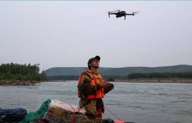
The work was carried out using the Sherpa software developed at VSEGEI and a quadcopter for orientation on the ground and compiling a detailed photographic map of the area for more detailed mapping of the site in the field.
Air route
Field work was carried out until the first snow, which falls in the Magadan Region in August.
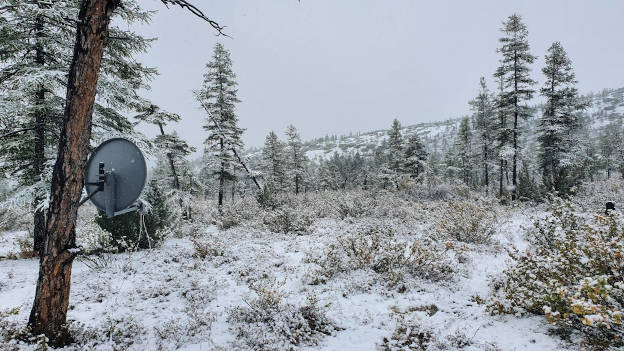
First snow
Based on the results of field studies-2020, the Balygychan Party obtained a large amount of new material for the compilation of the State Geological Map at a scale of 1: 200,000, sheets P-6-V, VI (Balygychan Area) as an up-to-date multifunctional geological basis for solving various economic problems. Areas promising for the discovery of noble metal mineralization were outlined.

