+7 (812) 328 9282 - Office, +7 (812) 328 9248 - Museum info@karpinskyinstitute.ru
Russian Geological Research Institute (VSEGEI)
From July 13 to September 9, 2020, the Vetrensky Field Group of the Department of Regional Geology and Mineral Resources of Eastern Regions of Russia, FGBU VSEGEI, carried out geological and geophysical surveys in the Magadan Region (sheets P-55-XXIV, P-56-XIX) under the task Conducting regional geological surveys at a scale of 1: 200,000 for a group of sheets within the Far Eastern Federal District (North-Eastern regions) in 2018-2020.
The expedition consisted of 9 people: S.D. Shvedov, head of the group, Yu.V. Vorobiev, chief geophysicist, M.G. Pushkin, leading geologist, M.V. Ignatova, 2nd category geologist, Sh.T. Akhmetzyanov, geo technician, M.B. Lunev, E.M. Kuznetsova and G.K. Grigoriev, 1st category geophysical technicians, V.I. Dudanova, worker.
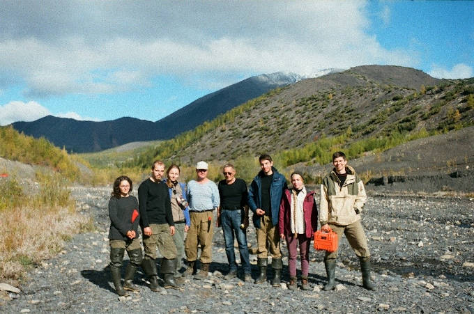
Members of the Vetrensky Field Group
In 2020, in the course of field work aimed at compiling a set of the State Geological Map at a scale of 1:200,000, sheets P-55-XXIV, P-56-XIX (Vetrensky area), the following tasks have been solving: additional study of petrochemical, petrographic and geochemical features, age, formation affinity and metallogenic trend of granitoid intrusions and dikes of various composition; amendment of boundaries of known and newly identified mineragenic taxa, promising for the discovery of mineral deposits; additional study and correction of the age, genesis, boundaries and areas of Quaternary formations. The works were carried out in the Munchan and Siberdik areas.
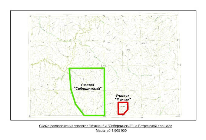
Location map of main work sites in the Vetrensky area
The work was mainly focused in the Munchan area promising for the identification of gold targets. Based on results of previous work, gold shows were identified in the bedrock in rocks of this area (dikes of intermediate and felsic composition and near-contact siltstone). The field work in 2020 was aimed at the identification and delineation of gold-bearing geological zones.
To solve the allotted tasks, exploration traverses at a scale of 1:50,000, special-purpose geological studies, electrical profiling (subsurface symmetrical induced polarization electrical profiling), electrical tomography (induced polarization), ground geological routes during geological surveying at a scale of 1:100,000 in Quaternary formations, various types of sampling were performed. During the expedition, the exploration routes covered 69.8 km; in addition, more than 240 samples were taken for chip and float sampling and 14 samples for determining the absolute age. The length of geological routes while studying Quaternary formations was 101.5 km; the number of samples for palynological, granulometric, OSL and radiocarbon analyzes is about 100 samples.
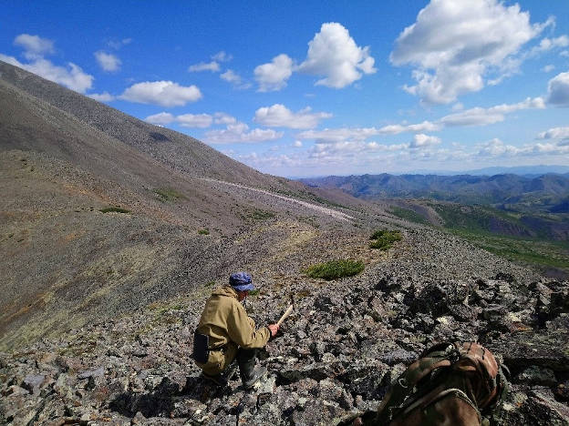
Rock sampling
As a result of geological and geophysical studies in the Munchan area, a potentially ore-bearing structure of submeridional strike was identified. As follows from the data obtained from geophysical studies and traversing, this structure is associated with the introduction of a series of intrusive bodies consisting of diorite and rhyolite dikes.
Thus, in the Munchan area, a dike-type manifestation related to the gold-quartz formation was found. In the future, the gold potential of the area will be checked using geochemical and petrographic analyzes of the obtained samples.
Rhyolite dike in the Munchan Stream course
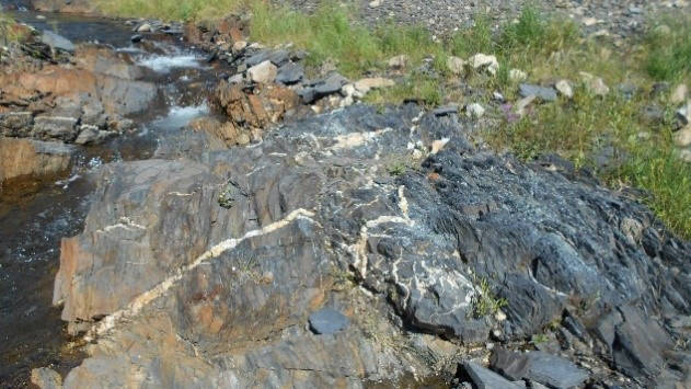
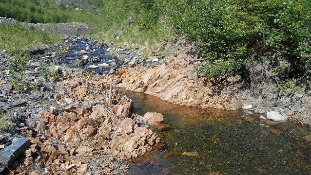
Siltstone silicified in the Munchan Stream course
In the course of additional studying the Quaternary formations, based on the traversing results in the Siberdik and Yaryga granite massifs, traces of four Pleistocene glaciations were identified (previously, from two to five glaciations were established in this area). Two stages are reliably identified on the Chalbykan granite massif. In addition, an assumption was made regarding older age of some strata of alluvial deposits traced in the Munchan and Siberdik areas, and material was collected for more precise determination of the stratigraphic position of the Bolshoi Siberdik River terrace drift. For the first time in the Magadan Region, the fact of diagenetic transformation of Quaternary alluvium with the formation of conglomerates was elicited (which may have a certain effect on the gold potential).
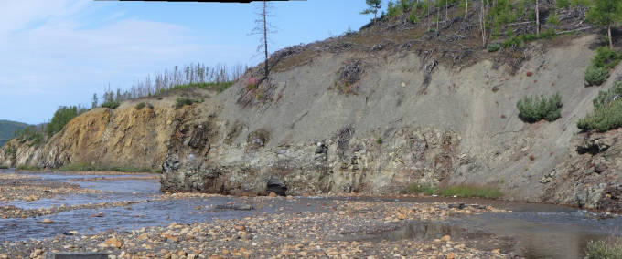
Terraces of Bolshoy Seberdik below the mouth of the Nochlezhny stream. In the foreground is a 7-10-meter terrace (on the basement of which a layer of Quaternary conglomerates up to 2 m thick has been discovered), then there is a 30-40-meter erosion terrace, and on the far left, there is a 15-20-meter basement terrace

