+7 (812) 328 9282 - Office, +7 (812) 328 9248 - Museum info@karpinskyinstitute.ru
Russian Geological Research Institute (VSEGEI)
From August 05 till 31, 2020, experts from the Lithogeodynamics and Minerageny of Sedimentary Basins Department of FGBU "VSEGEI" carried out field works within the southeastern edge of the Chersky mountain ranges (Magadan Region) within the framework of problem solving on the task "Assessment of geological, geochemical and geophysical study of sheets P-55-V, VI (Momontai area), stage 2".
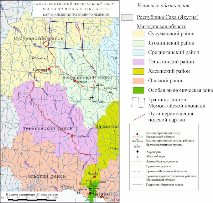
Review scheme map of field works location
The purpose of the work carried out is to collect geological information to compile the State geological maps at 1:200,000 scale and to assess the prospects of territories for various types of minerals.
4 people took part in the field work of the Taskansky Group the head of the group - K.P. Ryazanov, leading geologist - S.Yu. Engalychev, leading geologist - S.V. Yudin, exploration worker - V.S. Stativko (student of the Mining Institute). Transportation within the sections was carried out on the MTLB all-terrain vehicle.
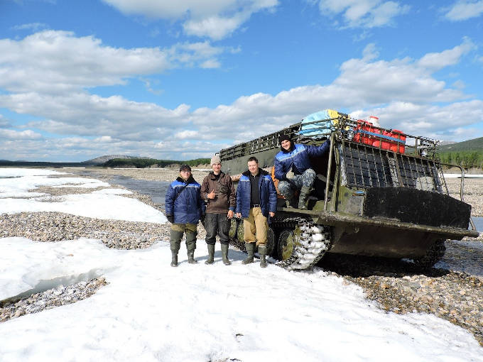
Taskansky Group (photo credit to S.V. Yudin)
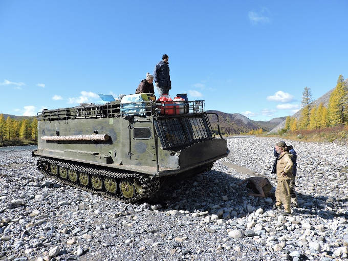
Moving to another base camp (photo credit to S.V. Yudin)
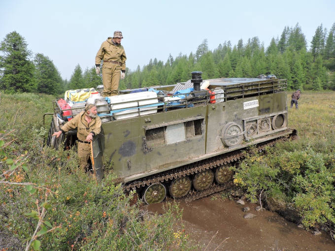
Stuck in the crossing (photo credit to S.V. Yudin)
There were field tractor roads on the field work area, that periodically coincided with the directions of movement of hunters and shepherds from reindeer breeding enterprises. At the same time, the territory of the sheet adjoins the large Berelekhsky gold-mining region (sheets P-55-IV, X, XI, etc.). From the Susuman settl., the administrative center of this region, the investigated territory is located 80 km to the north-east. This makes it accessable for industrial development. Occasionally there are rare hunting and fish huts, the remains of geologists' camps.
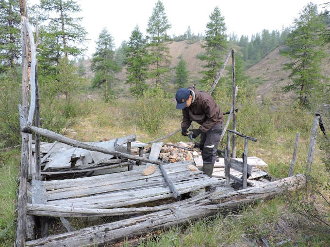
Remains of the geological camp on Taskan river (photo credit to S.V. Yudin)
Assessment of geological, geochemical and geophysical study on the area of sheets P-55-V, VI (7 359.4 sq. km) included the following types of field work:
- ground geological routes for the pre-Quaternary formations study at 1:200,000 scale;
- specialized concentrate mineralogical and isotope-geochemical studies;
- various types of sampling;
- field office processing of materials
For the field works, the following 2 main sites and paths of movement between them were selected:
1. Tuscan (main);
2. Lower Yasny (additional, prospecting).
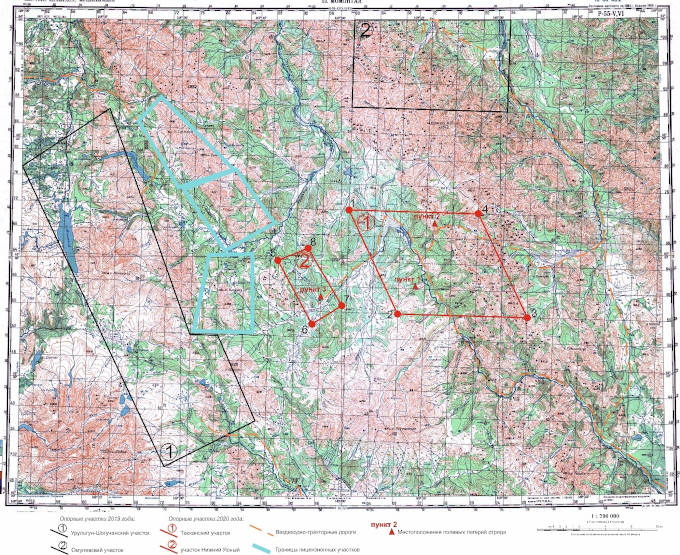
General layout of the support sites of the Taskan detachment, with approximate routes between them and the base camps on the territory of Momontai Square (sheet R-55-V, VI)
Within the boundaries of the Taskansky reference area there is a skarn silver-polymetallic ore occurrence "Terrasnoye" of the Dalnegorsk type - the mouth of the streem Terrasny, right tributary of the Taskan river. It has been studied and assessed (in the 70-80s of the last century), but the problematic issue is the mineralization age. For this purpose, samples were taken for U-Pb from acidic dikes in the area of this ore occurrence (in the left bank cliff of the Taskan River). The effusive rocks of the Upper Taskan trough were also sampled there.
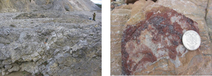
Outcrops of the Upper Silurian Bizonskaya Formation (Paralninskaya Series) at the contact with red-colored marbled limestone on the stream Vecherniy
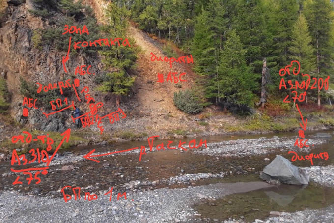
Sampling scheme for bedrock (felsic and basic dikes) on the right side of the river. Taskan
In the upper reaches of the streams Terrasny, Peresohshiy and Nadezhda were tested on U-Pb granitoids of the Khiulchansky massif, which is also associated with skarn silver-polymetallic and magnetite mineralization. Also, at the Taskansky site, the detachment's employees conducted a study of the Tuscan dolerite complex, the age of which is not precisely determined.
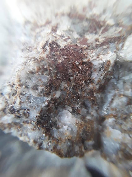
Sample of a dike with rich sulfide mineralization (oxbow of the Taskan River, left side)
Slope formations have the widest development within the Taskan area, in the Taskan River valley - alluvium of the channel, floodplain and at least two above-floodplain terraces, in the eastern part within the low mountains, glacial Late Neopleistocene deposits are likely. In the western part of the site, a smoothed, lower relief is developed, with absolute elevations of peaks 1000-1100 m, with the development of deluvial, desertion and solifluction deposits on the slopes. In the east, there is an intensely dissected low-mountain relief with a maximum peak elevation of 1359 m (southeast part of the site), with steep and medium-steep slopes with a predominant development of landslide and landslide-talus processes on them, forming colluvial and deluvial-colluvial deposits.
As a result of the fieldwork carried out at the Nizhny Yasny site in 2020, prospecting and geological survey routes were completed, a representative collection of typical rock varieties was collected, intrusive formations and areas of development of near-contact changes (hornfelses) up to 5 m thick were tested! In the zones of contact between dikes and host rocks, in a number of cases, zones of intense sulfide mineralization up to 0.3 m thick are recorded. Further studies will clarify the nature of the previously identified geochemical anomaly of gold. According to the available new geological data, the probability of a new gold ore occurrence is high. Samples were prepared for analytical studies.
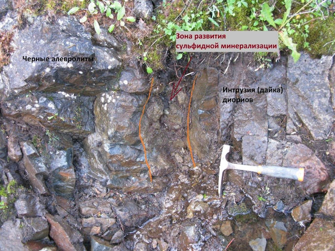
Zone of development of sulfide mineralization at the exocontact of the dike

Sign of visible gold in the tray after washing sand from the pit at the Nizhny Yasny site
Laboratory studies will make it possible to clarify the gold content in placer samples, but already now we can talk about a new area where placer gold is developed. This is new data obtained by VSEGEI staff during field work in 2020. The intensity and locality of the placer halo indicate the proximity of the primary source. It will be possible to identify it at the next stage of work, as part of the creation of the GDS-200 of the Momontai area.

